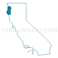
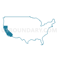
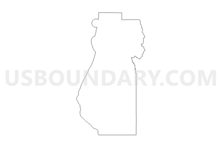
Humboldt County PUMA, California
About
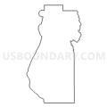
Outline
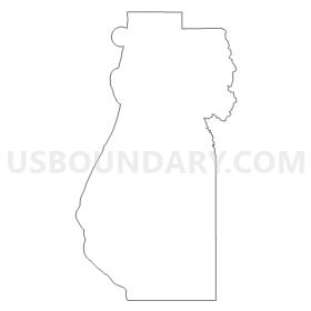
Summary
| Unique Area Identifier | 192252 |
| Name | Humboldt County PUMA |
| State | California |
| Area (square miles) | 4,052.26 |
| Land Area (square miles) | 3,567.99 |
| Water Area (square miles) | 484.27 |
| % of Land Area | 88.05 |
| % of Water Area | 11.95 |
| Latitude of the Internal Point | 40.70667310 |
| Longtitude of the Internal Point | -123.92581810 |
Maps
Graphs
Select a template below for downloading or customizing gragh for Humboldt County PUMA, California



Neighbors
Neighoring Public Use Microdata Area (by Name) Neighboring Public Use Microdata Area on the Map
- Colusa, Glenn, Tehama & Trinity Counties PUMA, CA
- Del Norte, Lassen, Modoc, Plumas & Siskiyou Counties PUMA, CA
- Lake & Mendocino Counties PUMA, CA
Top 10 Neighboring County (by Population) Neighboring County on the Map
- Humboldt County, CA (134,623)
- Mendocino County, CA (87,841)
- Siskiyou County, CA (44,900)
- Del Norte County, CA (28,610)
- Trinity County, CA (13,786)
Top 10 Neighboring County Subdivision (by Population) Neighboring County Subdivision on the Map
- Eureka CCD, Humboldt County, CA (48,424)
- Arcata CCD, Humboldt County, CA (23,495)
- North Coastal CCD, Humboldt County, CA (22,194)
- Fortuna CCD, Humboldt County, CA (17,847)
- Garberville CCD, Humboldt County, CA (13,518)
- Willow Creek-Hoopa Valley CCD, Humboldt County, CA (5,925)
- Laytonville-Leggett CCD, Mendocino County, CA (4,155)
- Smith River-Gasquet CCD, Del Norte County, CA (3,655)
- Etna CCD, Siskiyou County, CA (3,412)
- Ferndale CCD, Humboldt County, CA (3,220)
Top 10 Neighboring Place (by Population) Neighboring Place on the Map
- Eureka city, CA (27,191)
- Arcata city, CA (17,231)
- McKinleyville CDP, CA (15,177)
- Fortuna city, CA (11,926)
- Myrtletown CDP, CA (4,675)
- Humboldt Hill CDP, CA (3,414)
- Rio Dell city, CA (3,368)
- Pine Hills CDP, CA (3,131)
- Cutten CDP, CA (3,108)
- Bayview CDP, CA (2,510)
Top 10 Neighboring Elementary School District (by Population) Neighboring Elementary School District on the Map
- McKinleyville Union Elementary School District, CA (15,287)
- Arcata Elementary School District, CA (14,544)
- Fortuna Union Elementary School District, CA (7,443)
- South Bay Union Elementary School District, CA (6,914)
- Rohnerville Elementary School District, CA (6,053)
- Cutten Elementary School District, CA (5,228)
- Pacific Union Elementary School District, CA (4,771)
- Rio Dell Elementary School District, CA (3,453)
- Jacoby Creek Elementary School District, CA (2,642)
- Blue Lake Union Elementary School District, CA (2,515)
Top 10 Neighboring Secondary School District (by Population) Neighboring Secondary School District on the Map
- Northern Humboldt Union High School District, CA (44,379)
- Fortuna Union High School District, CA (22,641)
- Siskiyou Union High School District, CA (16,201)
- Trinity Alps Unified School District in Burnt Ranch, CA (803)
- Scott Valley Unified School District in Forks of Salmon, CA (211)
Top 10 Neighboring Unified School District (by Population) Neighboring Unified School District on the Map
- Eureka City Unified School District, CA (34,543)
- Del Norte County Unified School District, CA (28,610)
- Southern Humboldt Joint Unified School District, CA (8,564)
- Klamath-Trinity Joint Unified School District, CA (6,326)
- Mountain Valley Unified School District, CA (3,113)
- Laytonville Unified School District, CA (2,925)
- Ferndale Unified School District, CA (2,849)
- Southern Trinity Joint Unified School District, CA (1,078)
- Mattole Unified School District, CA (626)
- Leggett Valley Unified School District, CA (588)
Top 10 Neighboring State Legislative District Lower Chamber (by Population) Neighboring State Legislative District Lower Chamber on the Map
Top 10 Neighboring State Legislative District Upper Chamber (by Population) Neighboring State Legislative District Upper Chamber on the Map
Top 10 Neighboring 111th Congressional District (by Population) Neighboring 111th Congressional District on the Map
Top 10 Neighboring Census Tract (by Population) Neighboring Census Tract on the Map
- Census Tract 107, Humboldt County, CA (6,940)
- Census Tract 105.01, Humboldt County, CA (6,635)
- Census Tract 11.01, Humboldt County, CA (6,350)
- Census Tract 2, Humboldt County, CA (6,211)
- Census Tract 10, Humboldt County, CA (5,906)
- Census Tract 3, Humboldt County, CA (5,544)
- Census Tract 7, Humboldt County, CA (5,360)
- Census Tract 105.02, Humboldt County, CA (5,281)
- Census Tract 9, Humboldt County, CA (5,074)
- Census Tract 111, Humboldt County, CA (4,976)
Top 10 Neighboring 5-Digit ZIP Code Tabulation Area (by Population) Neighboring 5-Digit ZIP Code Tabulation Area on the Map
- 95503, CA (24,152)
- 95501, CA (23,976)
- 95521, CA (20,199)
- 95519, CA (17,432)
- 95540, CA (13,657)
- 95546, CA (3,494)
- 95562, CA (3,450)
- 95536, CA (2,849)
- 95570, CA (2,579)
- 95454, CA (2,556)


